


 关联应用
关联应用

NZ Topo50 South Island
Complete offline 1:50k map
开发者: Right Place Resources

123天11小时
最新版本上线距今
2
近1年版本更新次数
2013-02-27
全球最早版本上线日期
版本: 5.80.05
版本更新日期
2024-01-30
NZ Topo50 South Island
Complete offline 1:50k map
更新日志
Updated maps and data
Support for custom map images
New scrolling interface - more info where you need it
Duplicate tracks easily
Map alignment with course option
Dedicated fullscreen button
Other improvements
应用描述
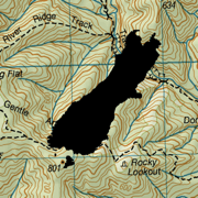
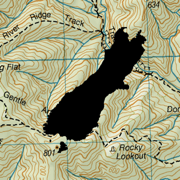
This app provides complete offline topographic map coverage of the South Island of New Zealand from the LINZ Topo50 1:50k scale map series. The maps are all contained in the installation so there is no additional need for downloads, no need for phone or wifi signal, no slow server issues, no account signups, no missing tiles, and no additional map fees. Just install for seamless off-line zooming and panning across the whole island down to 1:50k scale. The app also includes 1:50k resolution satellite images for the island, and elevation data.
Other integrated data includes DOC hunting permit boundaries, DOC huts, campgrounds, and tracks, Fish and Game access points, Te Araroa trails, Public Conservation Land boundaries, selected public road parcels. Other datasets can be imported.
The app has a full suite of navigation functions including GPS location, compass orientation, distance to map locations, track recording and graphing, route creation and following, import/export of gpx and kml files, search functions for named places and user data. Add and edit your own locations and routes and plot elevation profiles. Use your camera view to identify surrounding peaks and match with local topography. Uses an intuitive simple interface with one-touch access to all functions.
LINZ TOPO250 series maps are used at lower zoom levels for easier navigation.
Perfect for outback use out of cell phone range. GPS and maps function fully without phone coverage. No need to cache files in advance either as they are all fully installed with the app. Popular with trampers, hikers, runners, bikers, search and rescue (SAR), hunters, boaters, flying, paragliding, as well as survey applications.
Note that continuous use of GPS will run down the battery faster than when not using the GPS. The NZTopo50 app gives you full control over when GPS is used. The map can be used without GPS, intermittently with GPS for spot checking of location, continuously for logging while the app is open, or for continuous background logging when the phone is off.
Check our website for links to user guides and useful tips and tricks.
The in-app purchase is an optional contribution to ongoing app development. It doesn't affect the functionality of the app or the availability of updates.
Feel free to get in touch with any suggestions.版本: 5.80.01
版本更新日期
2023-09-08

NZ Topo50 South Island
Complete offline 1:50k map
更新日志
DOC restricted permit boundaries are back
Automatic backup option for your waypoints and tracks (turn it on in the settings)
New 'category' property for objects so that you can group them together by category name
Current position relative to an existing route is displayed on the elevation profile
Sunset/sunrise times are displayed in the track details应用描述
This app provides complete offline topographic map coverage of the South Island of New Zealand from the LINZ Topo50 1:50k scale map series. The maps are all contained in the installation so there is no additional need for downloads, no need for phone or wifi signal, no slow server issues, no account signups, no missing tiles, and no additional map fees. Just install for seamless off-line zooming and panning across the whole island down to 1:50k scale. The app also includes 1:50k resolution satellite images for the island, and elevation data.
Other integrated data includes DOC hunting permit boundaries, DOC huts, campgrounds, and tracks, Fish and Game access points, Te Araroa trails, Public Conservation Land boundaries, selected public road parcels. Other datasets can be imported.
The app has a full suite of navigation functions including GPS location, compass orientation, distance to map locations, track recording and graphing, route creation and following, import/export of gpx and kml files, search functions for named places and user data. Add and edit your own locations and routes and plot elevation profiles. Use your camera view to identify surrounding peaks and match with local topography. Uses an intuitive simple interface with one-touch access to all functions.
LINZ TOPO250 series maps are used at lower zoom levels for easier navigation.
Perfect for outback use out of cell phone range. GPS and maps function fully without phone coverage. No need to cache files in advance either as they are all fully installed with the app. Popular with trampers, hikers, runners, bikers, search and rescue (SAR), hunters, boaters, flying, paragliding, as well as survey applications.
Note that continuous use of GPS will run down the battery faster than when not using the GPS. The NZTopo50 app gives you full control over when GPS is used. The map can be used without GPS, intermittently with GPS for spot checking of location, continuously for logging while the app is open, or for continuous background logging when the phone is off.
Check our website for links to user guides and useful tips and tricks.
The in-app purchase is an optional contribution to ongoing app development. It doesn't affect the functionality of the app or the availability of updates.
Feel free to get in touch with any suggestions.版本: 5.70.12
版本更新日期
2023-05-03

NZ Topo50 South Island
Complete offline 1:50k map
更新日志
Improved peak finder overlay with landscape profile
DOC restricted permit hunting boundaries are back
Nautical Mile units
Other improvements应用描述
This app provides complete offline topographic map coverage of the South Island of New Zealand from the LINZ Topo50 1:50k scale map series. The maps are all contained in the installation so there is no additional need for downloads, no need for phone or wifi signal, no slow server issues, no account signups, no missing tiles, and no additional map fees. Just install for seamless off-line zooming and panning across the whole island down to 1:50k scale. The app also includes 1:50k resolution satellite images for the island, and elevation data.
Other integrated data includes DOC hunting permit boundaries, DOC huts, campgrounds, and tracks, Fish and Game access points, Te Araroa trails, Public Conservation Land boundaries, selected public road parcels. Other datasets can be imported.
The app has a full suite of navigation functions including GPS location, compass orientation, distance to map locations, track recording and graphing, route creation and following, import/export of gpx and kml files, search functions for named places and user data. Add and edit your own locations and routes and plot elevation profiles. Use your camera view to identify surrounding peaks and match with local topography. Uses an intuitive simple interface with one-touch access to all functions.
LINZ TOPO250 series maps are used at lower zoom levels for easier navigation.
Perfect for outback use out of cell phone range. GPS and maps function fully without phone coverage. No need to cache files in advance either as they are all fully installed with the app. Popular with trampers, hikers, runners, bikers, search and rescue (SAR), hunters, boaters, flying, paragliding, as well as survey applications.
Note that continuous use of GPS will run down the battery faster than when not using the GPS. The NZTopo50 app gives you full control over when GPS is used. The map can be used without GPS, intermittently with GPS for spot checking of location, continuously for logging while the app is open, or for continuous background logging when the phone is off.
Check our website for links to user guides and useful tips and tricks.
Feel free to get in touch with any suggestions.版本: 5.70.03
版本更新日期
2023-03-03

NZ Topo50 South Island
Complete offline 1:50k map
更新日志
New data layers including public conservation land boundaries, selected road parcels, DOC mountain biking tracks
Basic identification of nearby peaks in camera view
Naismith walking times calculated for routes and tracks
Dedicated fullscreen button
Dedicated pause button for track recording
UI changes and other improvements
应用描述
This app provides complete offline topographic map coverage of the South Island of New Zealand from the LINZ Topo50 1:50k scale map series. The maps are all contained in the installation so there is no additional need for downloads, no need for phone or wifi signal, no slow server issues, no account signups, no missing tiles, and no additional map fees. Just install for seamless off-line zooming and panning across the whole island down to 1:50k scale. The app also includes 1:50k resolution satellite images for the island, and elevation data.
Other integrated data includes DOC open hunting permit boundaries, DOC huts, campgrounds, and tracks, Fish and Game access points, Te Araroa trails, Public Conservation Land boundaries, selected public road parcels. Other datasets can be imported.
The app has a full suite of navigation functions including GPS location, compass orientation, distance to map locations, track recording and graphing, route creation and following, import/export of gpx and kml files, search functions for named places and user data. Add and edit your own locations and routes and plot elevation profiles. Uses an intuitive simple interface, with one-touch access to all functions.
LINZ TOPO250 series maps are used at lower zoom levels for easier navigation.
Perfect for outback use out of cell phone range. GPS and maps function fully without phone coverage. No need to cache files in advance either as they are all fully installed with the app. Popular with trampers, hikers, runners, bikers, search and rescue (SAR), hunters, boaters, flying, paragliding, as well as survey applications.
Note that continuous use of GPS will run down the battery faster than when not using the GPS. The NZTopo50 app gives you full control over when GPS is used. The map can be used without GPS, intermittently with GPS for spot checking of location, continuously for logging while the app is open, or for continuous background logging when the phone is off.
Check our website for links to user guides and useful tips and tricks.
Feel free to get in touch with any suggestions.版本: 5.61
版本更新日期
2022-03-25

NZ Topo50 South Island
Complete offline 1:50k map
更新日志
New options for adjusting GPS state on startup, opacity of overlays, transition between 1:250k and 1:50 maps.
Improvements to grouping and processing of user data, import/export, and background recording.应用描述
This app provides complete offline topographic map coverage of the South Island of New Zealand from the LINZ Topo50 1:50k scale map series. The maps are all contained in the installation so there is no additional need for downloads, no need for phone or wifi signal, no slow server issues, no account signups, no missing tiles, and no additional map fees. Just install for seamless off-line zooming and panning across the whole island down to 1:50,000 scale. The app also includes 1:50k resolution satellite images for the island and elevation data.
Other integrated data includes DOC open and restricted hunting permit boundaries, DOC huts, campgrounds, and tracks, Fish and Game access points, and Te Araroa trails. Other datasets can be imported.
The app has a full suite of navigation functions including GPS location, compass orientation, distance to map locations, track recording and graphing, route creation and following, import/export of gpx and kml files, search functions for named places and user data. Add and edit your own locations and routes and plot elevation profiles. Uses an intuitive simple interface, with one-touch access to all functions.
LINZ TOPO250 series maps are used at lower zoom levels for easier navigation.
Perfect for outback use out of cell phone range. GPS and maps function fully without phone coverage. No need to cache files in advance either as they are all fully installed with the app. Popular with trampers, hikers, runners, bikers, search and rescue (SAR), hunters, boaters, as well as survey applications.
Note that continuous use of GPS will run down the battery faster than when not using the GPS. The NZTopo50 app gives you full control over when GPS is used. The map can be used without GPS, intermittently with GPS for spot checking of location, continuously for logging while the app is open, or for continuous background logging when the phone is off.
Check our website for links to user guides and useful tips and tricks.
Feel free to get in touch with any suggestions.版本: 5.6
版本更新日期
2021-11-19
NZ Topo50 South Island
Complete offline 1:50k map
更新日志
Integrated altitude data for building elevation profiles
Search radius projection around waypoints
Filter and edit tracks by group
Full colour icons
Improved track editing - split, continue recording, create regions
Navigate by course or compass bearing
Other UI improvements应用描述
This app provides complete offline topographic map coverage of the South Island of New Zealand from the LINZ Topo50 1:50k scale map series. The maps are all contained in the installation so there is no additional need for downloads, no need for phone or wifi signal, no slow server issues, no account signups, no missing tiles, and no additional map fees. Just install for seamless off-line zooming and panning across the whole island down to 1:50,000 scale. The app also includes 1:50k resolution satellite images for the island and elevation data.
Other integrated data includes DOC open and restricted hunting permit boundaries, DOC huts, campgrounds, and tracks, Fish and Game access points, and Te Araroa trails. Other datasets can be imported.
The app has a full suite of navigation functions including GPS location, compass orientation, distance to map locations, track recording and graphing, route creation and following, import/export of gpx and kml files, search functions for named places and user data. Add and edit your own locations and routes and plot elevation profiles. Uses an intuitive simple interface, with one-touch access to all functions.
LINZ TOPO250 series maps are used at lower zoom levels for easier navigation.
Perfect for outback use out of cell phone range. GPS and maps function fully without phone coverage. No need to cache files in advance either as they are all fully installed with the app. Popular with trampers, hikers, runners, bikers, search and rescue (SAR), hunters, boaters, as well as survey applications.
Note that continuous use of GPS will run down the battery faster than when not using the GPS. The NZTopo50 app gives you full control over when GPS is used. The map can be used without GPS, intermittently with GPS for spot checking of location, continuously for logging while the app is open, or for continuous background logging when the phone is off.
Check our website for links to user guides and useful tips and tricks.
Feel free to get in touch with any suggestions.版本: 5.5
版本更新日期
2021-11-06

NZ Topo50 South Island
Complete offline 1:50k map
更新日志
Integrated altitude data for building elevation profiles
Search radius projection around waypoints
Filter and edit tracks by group
Full colour icons
Improved track editing - split, continue recording, create regions
Navigate by course or compass bearing
Other UI improvements应用描述
This app provides complete offline topographic map coverage of the South Island of New Zealand from the LINZ Topo50 1:50k scale map series. The maps are all contained in the installation so there is no additional need for downloads, no need for phone or wifi signal, no slow server issues, no account signups, no missing tiles, and no additional map fees. Just install for seamless off-line zooming and panning across the whole island down to 1:50,000 scale. The app also includes 1:50k resolution satellite images for the island and elevation data.
Other integrated data includes DOC open and restricted hunting permit boundaries, DOC huts, campgrounds, and tracks, Fish and Game access points, and Te Araroa trails. Other datasets can be imported.
The app has a full suite of navigation functions including GPS location, compass orientation, distance to map locations, track recording and graphing, route creation and following, import/export of gpx and kml files, search functions for named places and user data. Add and edit your own locations and routes and plot elevation profiles. Uses an intuitive simple interface, with one-touch access to all functions.
LINZ TOPO250 series maps are used at lower zoom levels for easier navigation.
Perfect for outback use out of cell phone range. GPS and maps function fully without phone coverage. No need to cache files in advance either as they are all fully installed with the app. Popular with trampers, hikers, runners, bikers, search and rescue (SAR), hunters, boaters, as well as survey applications.
Note that continuous use of GPS will run down the battery faster than when not using the GPS. The NZTopo50 app gives you full control over when GPS is used. The map can be used without GPS, intermittently with GPS for spot checking of location, continuously for logging while the app is open, or for continuous background logging when the phone is off.
Check our website for links to user guides and useful tips and tricks.
Feel free to get in touch with any suggestions.版本: 5.3
版本更新日期
2021-03-05

NZ Topo50 South Island
Complete offline 1:50k map
更新日志
'Show All' option added
Startup sequence streamlined for quick start
Apostrophe's accommodated in search terms
Hunting block names displayed on screen应用描述
This app provides complete offline topographic map coverage of the South Island of New Zealand from the LINZ Topo50 1:50k scale series. The maps are all contained in the (large) install file so there is no additional need for downloads, no need for phone or wifi signal, no slow server issues, no account signups, no missing tiles, and no additional map fees. Just install for seamless off-line zooming and panning across the whole island down to 1:50,000 scale.
A modest resolution satellite map for the island is included. Toggle easily between satellite and topographic maps with the on-screen button.
The app includes DOC open and restricted hunting permit boundaries as overlays that can be switched on or off.
A full suite of navigation functions includes current location marking (GPS), compass orientation, distance to map locations, track recording and graphing, route creation and following, import/export of gpx and kml files, and a search function for named places on the map. Add and edit your own locations and routes. Intuitive simple interface, with one-touch access to all functions.
The app includes NZ TOPO250 series images at lower zoom levels for easier navigation.
Perfect for outback use out of cell phone range. GPS and maps function fully without phone coverage. No need to cache files in advance either as they are all fully installed with the app. Popular with trampers, hikers, runners, bikers, SARs, hunters, boaters, as well as professional survey applications.
Note that continuous use of GPS will run down the battery faster than when not using the GPS. The NZTopo50 app gives you full control over when GPS is used. The map can be used without GPS, intermittently with GPS for spot checking of location, continuously for logging while the app is open, or for continuous background logging when the phone is off.
Check our website for links to Te Araroa and other popular trails that can be imported.
Feel free to get in touch with any suggestions.版本: 5.2
版本更新日期
2021-01-15

NZ Topo50 South Island
Complete offline 1:50k map
更新日志
New built in data: DOC huts, tracks, and campsites; Te Araroa; Fish and Game access points
Quick link for entering grid references and offsets
Some UI changes for easier legibility and use应用描述
This app provides complete offline topographic map coverage of the South Island of New Zealand from the LINZ Topo50 1:50k scale series. The maps are all contained in the (large) install file so there is no additional need for downloads, no need for phone or wifi signal, no slow server issues, no account signups, no missing tiles, and no additional map fees. Just install for seamless off-line zooming and panning across the whole island down to 1:50,000 scale.
A modest resolution satellite map for the island is included. Toggle easily between satellite and topographic maps with the on-screen button.
The app includes DOC open and restricted hunting permit boundaries as overlays that can be switched on or off.
A full suite of navigation functions includes current location marking (GPS), compass orientation, distance to map locations, track recording and graphing, route creation and following, import/export of gpx and kml files, and a search function for named places on the map. Add and edit your own locations and routes. Intuitive simple interface, with one-touch access to all functions.
The app includes NZ TOPO250 series images at lower zoom levels for easier navigation.
Perfect for outback use out of cell phone range. GPS and maps function fully without phone coverage. No need to cache files in advance either as they are all fully installed with the app. Popular with trampers, hikers, runners, bikers, SARs, hunters, boaters, as well as professional survey applications.
Note that continuous use of GPS will run down the battery faster than when not using the GPS. The NZTopo50 app gives you full control over when GPS is used. The map can be used without GPS, intermittently with GPS for spot checking of location, continuously for logging while the app is open, or for continuous background logging when the phone is off.
Check our website for links to Te Araroa and other popular trails that can be imported.
Feel free to get in touch with any suggestions.版本: 5.1
版本更新日期
2020-09-25
NZ Topo50 South Island
Complete offline 1:50k map
更新日志
True/Magnetic compass options
Satellite image layer
Add photos or images to waypoints and tracks
Icon size control, and new icon design
More details added to track information page
Enter an offset from a waypoint or map position应用描述
This app provides complete offline topographic map coverage of the South Island of New Zealand from the LINZ Topo50 1:50k scale series. The maps are all contained in the (large) install file so there is no additional need for downloads, no need for phone or wifi signal, no slow server issues, no account signups, no missing tiles, and no additional map fees. Just install for seamless off-line zooming and panning across the whole island down to 1:50,000 scale.
A modest resolution satellite map for the island is included. Toggle easily between satellite and topographic maps with the on-screen button.
The app includes DOC open and restricted hunting permit boundaries as overlays that can be switched on or off.
A full suite of navigation functions includes current location marking (GPS), compass orientation, distance to map locations, track recording and graphing, route creation and following, import/export of gpx and kml files, and a search function for named places on the map. Add and edit your own locations and routes. Intuitive simple interface, with one-touch access to all functions.
The app includes NZ TOPO250 series images at lower zoom levels for easier navigation.
Perfect for outback use out of cell phone range. GPS and maps function fully without phone coverage. No need to cache files in advance either as they are all fully installed with the app. Popular with trampers, hikers, runners, bikers, SARs, hunters, boaters, as well as professional survey applications.
Note that continuous use of GPS will run down the battery faster than when not using the GPS. The NZTopo50 app gives you full control over when GPS is used. The map can be used without GPS, intermittently with GPS for spot checking of location, continuously for logging while the app is open, or for continuous background logging when the phone is off.
Check our website for links to Te Araroa and other popular trails that can be imported.
Feel free to get in touch with any suggestions.


微信公众号

七麦数据公众号

七麦研究院公众号
APP下载
- IOS
- Android

@2014-2022 qimai.cn,北京七麦科技股份有限公司 All Rights Reserved. 京ICP备14049953号
 京公网安备 11010502041000号


