


 关联应用
关联应用

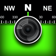
Solocator - GPS Field Camera
Stamp info on photos for proof
开发者: Civi Corp

15天10小时
最新版本上线距今
3
近1年版本更新次数
2012-12-04
全球最早版本上线日期
版本: 2.20
版本更新日期
2024-05-14
Solocator - GPS Field Camera
Stamp info on photos for proof
更新日志
- Added options for autosaving photos to your camera roll. You can save photos to a Solocator album or Solocator album with the addition of date or project name.
- Added option to enable or disable position accuracy.
- Customisable email and export buttons now include the selected KMZ photo size.
- Ul changes for editing notes fields from the Solocator photo library.
- Added nil date separator option.
- Added long date format and the addition of yellow in text color choices.
- Added warning when exporting/emailing files larger than device memory or storage that may lead to data loss.
- Bug Fix: an intermittent crash retrieving location data when taking a photo.
- Moved share action button to bottom taskbar when viewing individual photos.应用描述
Solocator is a GPS camera for fieldwork or when you need photos for proof. Overlay and stamp photos with location, direction, altitude, date & time taken. With the Industry Pack (In-App Purchase), capture field notes such as project name, photo description, company or username.
Solocator is used by many industries, government agencies and professionals across the globe for photo documentation.
TAILOR OVERLAY INFORMATION TO YOUR NEEDS
Select information you need to capture & stamp on your photos:
+ GPS position (Latitude & Longitude in various formats) ± Accuracy
+ UTM/MGRS coordinate formats (Industry Pack)
+ Compass direction–bearing
+ Altitude (Metric & Imperial units)
+ Tilt & Roll angles
+ Crosshair
+ Local date & time based on your GPS location
+ Local time zone
+ UTC time
+ Show compass
+ Street address (Industry Pack)
+ Show cardinal direction in Building mode, e.g. North elevation of a building face.
+ Option to use abbreviations or Unicode characters for direction, position and altitude.
CAMERA
Overlays are designed for both back and front selfie cameras. Ultra-wide angle and pre-set zoom buttons are supported within pinch zoom, plus other standard camera controls, including self-timer, flash and exposure.
AUTOSAVE PHOTOS TO iCLOUD & CAMERA ROLL
Take and autosave two photos at once: one stamped with the selected overlays and the other as an original high-resolution photo.
SORT, SEARCH, SHARE OR EMAIL
+ Photos are sorted by time, location, distance from current location and project name if using the Industry Pack.
+ View photo direction and location in map view and navigate there.
+ Share photos individually or as a zip file via the share sheet.
+ Search for photos by date, date range or with the Industry Pack search by text used in notes and address.
+ Email photos including the following information:
- Exif metadata
- Compass direction
- GPS position ± accuracy
- Altitude
- Tilt & Roll
- Date & time taken
- Street address (Industry Pack)
- Elevation of building face viewed
- Links to maps so the receiver can navigate there easily
INDUSTRY PACK (In-App Purchase) “One-time charge”
EDITABLE NOTES OVERLAY
Stamp your photos with "Project name", "Description" & “Watermark”. The Project Name field could be used as a job or ticket number. The Watermark field is typically used for company or username. You can also edit these fields later.
CUSTOM EXPORT FILENAME
Define your photo export filename from a selection of fields: Project Name, Description, Watermark, Street Address, Date/Time, Number# and the Custom text field.
BATCH EDIT NOTES OVERLAY FIELDS
Select multiple photos from the library and edit Project Name, Description & Watermark fields in one go.
STREET ADDRESS & UTM/MGRS
Add street address to your overlay or use UTM/, UTM Bands & MGRS coordinate formats instead of Lat/Long.
AUTOSAVE OR EXPORT PHOTOS TO CLOUD STORAGE
Autosave original and stamped photos to Google Drive, Dropbox, and OneDrive (Personal & For Business), including SharePoint Sites and Teams. You can also save photos in date or project name subfolders - automatically. Or select and export photos later.
PHOTO DATA in KML, KMZ & CSV
Along with photos, email or export photo data and notes in KML, KMZ or CSV formats. Both email and export buttons are customisable to suit your data requirements.
TRACK PHOTOS IN MAP VIEW
View photos by direction, the distance between photos, area of photos taken and distance to your added markers via imported KML files or dropped pins.
REFINE & LOCK GPS LOCATION
Ideal for those working in and around buildings; to improve your GPS location. You can also use it to lock the asset position you're photographing.
COMPACT VIEW
Switch off Compass, Building and Street modes and only show the GPS info bar on top of photos for a more compact view.
VPP Customers: https://solocator.com/enterprise-app-for-mdms/
Terms of Use: https://www.apple.com/legal/internet-services/itunes/dev/stdeula/版本: 2.19
版本更新日期
2024-02-27

Solocator - GPS Field Camera
Stamp info on photos for proof
更新日志
- Added option to select photo extension JPG or HEIC.
- Added option to use passcode and biometrics to limit access to the app.
- Updated framework for using volume buttons as the shutter button.
- Added a selection of photo sizes for KMZ files in the customised email/export buttons section.
- Added option to auto save photos to the cloud via WIFI only.
- Fixed landscape orientation issue for iPad 8th Gen.
- Minor Ul improvements and Bug fixes.应用描述
Solocator is a GPS camera for fieldwork or when you need photos for proof. Overlay and stamp photos with location, direction, altitude, date & time taken. With the Industry Pack (In-App Purchase), capture field notes such as project name, photo description, company or username.
Solocator is used by many industries, government agencies and professionals across the globe for photo documentation.
TAILOR OVERLAY INFORMATION TO YOUR NEEDS
Select information you need to capture & stamp on your photos:
+ GPS position (Latitude & Longitude in various formats) ± Accuracy
+ UTM/MGRS coordinate formats (Industry Pack)
+ Compass direction–bearing
+ Altitude (Metric & Imperial units)
+ Tilt & Roll angles
+ Crosshair
+ Local date & time based on your GPS location
+ Local time zone
+ UTC time
+ Show compass
+ Street address (Industry Pack)
+ Show cardinal direction in Building mode, e.g. North elevation of a building face.
+ Option to use abbreviations or Unicode characters for direction, position and altitude.
CAMERA
Overlays are designed for both back and front selfie cameras. Ultra-wide angle and pre-set zoom buttons are supported within pinch zoom, plus other standard camera controls, including self-timer, flash and exposure.
AUTOSAVE PHOTOS TO iCLOUD & CAMERA ROLL
Take and autosave two photos at once: one stamped with the selected overlays and the other as an original high-resolution photo.
SORT, SEARCH, SHARE OR EMAIL
+ Photos are sorted by time, location, distance from current location and project name if using the Industry Pack.
+ View photo direction and location in map view and navigate there.
+ Share photos individually or as a zip file via the share sheet.
+ Search for photos by date, date range or with the Industry Pack search by text used in notes and address.
+ Email photos including the following information:
- Exif metadata
- Compass direction
- GPS position ± accuracy
- Altitude
- Tilt & Roll
- Date & time taken
- Street address (Industry Pack)
- Elevation of building face viewed
- Links to maps so the receiver can navigate there easily
INDUSTRY PACK (In-App Purchase) “One-time charge”
EDITABLE NOTES OVERLAY
Stamp your photos with "Project name", "Description" & “Watermark”. The Project Name field could be used as a job or ticket number. The Watermark field is typically used for company or username. You can also edit these fields later.
CUSTOM EXPORT FILENAME
Define your photo export filename from a selection of fields: Project Name, Description, Watermark, Street Address, Date/Time, Number# and the Custom text field.
BATCH EDIT NOTES OVERLAY FIELDS
Select multiple photos from the library and edit Project Name, Description & Watermark fields in one go.
STREET ADDRESS & UTM/MGRS
Add street address to your overlay or use UTM/, UTM Bands & MGRS coordinate formats instead of Lat/Long.
AUTOSAVE OR EXPORT PHOTOS TO CLOUD STORAGE
Autosave original and stamped photos to Google Drive, Dropbox, and OneDrive (Personal & For Business), including SharePoint Sites and Teams. You can also save photos in date or project name subfolders - automatically. Or select and export photos later.
PHOTO DATA in KML, KMZ & CSV
Along with photos, email or export photo data and notes in KML, KMZ or CSV formats. Both email and export buttons are customisable to suit your data requirements.
TRACK PHOTOS IN MAP VIEW
View photos by direction, the distance between photos, area of photos taken and distance to your added markers via imported KML files or dropped pins.
REFINE & LOCK GPS LOCATION
Ideal for those working in and around buildings; to improve your GPS location. You can also use it to lock the asset position you're photographing.
COMPACT VIEW
Switch off Compass, Building and Street modes and only show the GPS info bar on top of photos for a more compact view.
VPP Customers: https://solocator.com/enterprise-app-for-mdms/
Terms of Use: https://www.apple.com/legal/internet-services/itunes/dev/stdeula/版本: 2.18
版本更新日期
2023-08-26

Solocator - GPS Field Camera
Stamp info on photos for proof
更新日志
- Option to share original photos from the Solocator app library.
- Option to save original photos to camera roll from Solocator app library.
- Increased camera range (180°) for landscape orientation.
- Added user-defined sort options for emailing.
- Added filename fields separator selection.
- UI changes to the Lock GPS Location screen.
- Bug fix for tilt readings.
- Option to rotate photo orientation in library edit if incorrectly captured.
- Added photo format options "high efficiency” or “most compatible” in settings.
- Export photo size fix for some devices.
- Screen size fix for iPad mini (6th gen).应用描述
Solocator is a GPS camera for fieldwork or when you need photos for proof. Overlay and stamp photos with location, direction, altitude, date & time taken. With the Industry Pack (In-App Purchase), capture field notes such as project name, photo description, company or username.
Solocator is used by many industries, government agencies and professionals across the globe for photo documentation.
TAILOR OVERLAY INFORMATION TO YOUR NEEDS
Select information you need to capture & stamp on your photos:
+ GPS position (Latitude & Longitude in various formats) ± Accuracy
+ UTM/MGRS coordinate formats (Industry Pack)
+ Compass direction–bearing
+ Altitude (Metric & Imperial units)
+ Tilt & Roll angles
+ Crosshair
+ Local date & time based on your GPS location
+ Local time zone
+ UTC time
+ Show compass
+ Street address (Industry Pack)
+ Show cardinal direction in Building mode, e.g. North elevation of a building face.
+ Option to use abbreviations or Unicode characters for direction, position and altitude.
CAMERA
Overlays are designed for both back and front selfie cameras. Ultra-wide angle and pre-set zoom buttons are supported within pinch zoom, plus other standard camera controls, including self-timer, flash and exposure.
AUTOSAVE PHOTOS TO iCLOUD & CAMERA ROLL
Take and autosave two photos at once: one stamped with the selected overlays and the other as an original high-resolution photo.
SORT, SEARCH, SHARE OR EMAIL
+ Photos are sorted by time, location, distance from current location and project name if using the Industry Pack.
+ View photo direction and location in map view and navigate there.
+ Share photos individually or as a zip file via the share sheet.
+ Search for photos by date, date range or with the Industry Pack search by text used in notes and address.
+ Email photos including the following information:
- Exif metadata
- Compass direction
- GPS position ± accuracy
- Altitude
- Tilt & Roll
- Date & time taken
- Street address (Industry Pack)
- Elevation of building face viewed
- Links to maps so the receiver can navigate there easily
INDUSTRY PACK (In-App Purchase) “One-time charge”
EDITABLE NOTES OVERLAY
Stamp your photos with "Project name", "Description" & “Watermark”. The Project Name field could be used as a job or ticket number. The Watermark field is typically used for company or username. You can also edit these fields later.
CUSTOM EXPORT FILENAME
Define your photo export filename from a selection of fields: Project Name, Description, Watermark, Street Address, Date/Time, Number# and the Custom text field.
BATCH EDIT NOTES OVERLAY FIELDS
Select multiple photos from the library and edit Project Name, Description & Watermark fields in one go.
STREET ADDRESS & UTM/MGRS
Add street address to your overlay or use UTM/, UTM Bands & MGRS coordinate formats instead of Lat/Long.
AUTOSAVE OR EXPORT PHOTOS TO CLOUD STORAGE
Autosave original and stamped photos to Google Drive, Dropbox, and OneDrive (Personal & For Business), including SharePoint Sites and Teams. You can also save photos in date or project name subfolders - automatically. Or select and export photos later.
PHOTO DATA in KML, KMZ & CSV
Along with photos, email or export photo data and notes in KML, KMZ or CSV formats. Both email and export buttons are customisable to suit your data requirements.
TRACK PHOTOS IN MAP VIEW
View photos by direction, the distance between photos, area of photos taken and distance to your added markers via imported KML files or dropped pins.
REFINE & LOCK GPS LOCATION
Ideal for those working in and around buildings; to improve your GPS location. You can also use it to lock the asset position you're photographing.
COMPACT VIEW
Switch off Compass, Building and Street modes and only show the GPS info bar on top of photos for a more compact view.
VPP Customers: https://solocator.com/enterprise-app-for-mdms/
Terms of Use: https://www.apple.com/legal/internet-services/itunes/dev/stdeula/版本: 2.17
版本更新日期
2023-03-24

Solocator - GPS Field Camera
Stamp info on photos for proof
更新日志
- Added address format to batch editing of geospatial information.
- Added native mail app to export share sheet.
- Fixed an issue exporting zip files for some users.
- Fixed export photo sizes for iPad Air using iOS 12.
- Updated support for device display zoom.
- Minor camera UI improvements, including using volume buttons as a camera shutter.
- Project name subfolders now support special characters (e.g. #, /, >) when autosaving photos to the cloud.应用描述
Solocator is a GPS camera for fieldwork or when you need photos for proof. Overlay and stamp photos with location, direction, altitude, date & time taken. With the Industry Pack (In-App Purchase), capture field notes such as project name, photo description, company or username.
Solocator is used by many industries, government agencies and professionals across the globe for photo documentation.
TAILOR OVERLAY INFORMATION TO YOUR NEEDS
Select information you need to capture & stamp on your photos:
+ GPS position (Latitude & Longitude in various formats) ± Accuracy
+ UTM/MGRS coordinate formats (Industry Pack)
+ Compass direction–bearing
+ Altitude (Metric & Imperial units)
+ Tilt & Roll angles
+ Crosshair
+ Local date & time based on your GPS location
+ Local time zone
+ UTC time
+ Show compass
+ Street address (Industry Pack)
+ Show cardinal direction in Building mode, e.g. North elevation of a building face.
+ Option to use abbreviations or Unicode characters for direction, position and altitude.
CAMERA
Overlays are designed for both back and front selfie cameras. Ultra-wide angle and pre-set zoom buttons are supported within pinch zoom, plus other standard camera controls, including self-timer, flash and exposure.
AUTOSAVE PHOTOS TO iCLOUD & CAMERA ROLL
Take and autosave two photos at once: one stamped with the selected overlays and the other as an original high-resolution photo.
SORT, SEARCH, SHARE OR EMAIL
+ Photos are sorted by time, location, distance from current location and project name if using the Industry Pack.
+ View photo direction and location in map view and navigate there.
+ Share photos individually or as a zip file via the share sheet.
+ Search for photos by date, date range or with the Industry Pack search by text used in notes and address.
+ Email photos including the following information:
- Exif metadata
- Compass direction
- GPS position ± accuracy
- Altitude
- Tilt & Roll
- Date & time taken
- Street address (Industry Pack)
- Elevation of building face viewed
- Links to maps so the receiver can navigate there easily
INDUSTRY PACK (In-App Purchase) “One-time charge”
EDITABLE NOTES OVERLAY
Stamp your photos with "Project name", "Description" & “Watermark”. The Project Name field could be used as a job or ticket number. The Watermark field is typically used for company or username. You can also edit these fields later.
CUSTOM EXPORT FILENAME
Define your photo export filename from a selection of fields: Project Name, Description, Watermark, Street Address, Date/Time, Number# and the Custom text field.
BATCH EDIT NOTES OVERLAY FIELDS
Select multiple photos from the library and edit Project Name, Description & Watermark fields in one go.
STREET ADDRESS & UTM/MGRS
Add street address to your overlay or use UTM/, UTM Bands & MGRS coordinate formats instead of Lat/Long.
AUTOSAVE OR EXPORT PHOTOS TO CLOUD STORAGE
Autosave original and stamped photos to Google Drive, Dropbox, and OneDrive (Personal & For Business), including SharePoint Sites and Teams. You can also save photos in date or project name subfolders - automatically. Or select and export photos later.
PHOTO DATA in KML, KMZ & CSV
Along with photos, email or export photo data and notes in KML, KMZ or CSV formats. Both email and export buttons are customisable to suit your data requirements.
TRACK PHOTOS IN MAP VIEW
View photos by direction, the distance between photos, area of photos taken and distance to your added markers via imported KML files or dropped pins.
REFINE & LOCK GPS LOCATION
Ideal for those working in and around buildings; to improve your GPS location. You can also use it to lock the asset position you're photographing.
COMPACT VIEW
Switch off Compass, Building and Street modes and only show the GPS info bar on top of photos for a more compact view.
VPP Customers: https://solocator.com/enterprise-app-for-mdms/
Terms of Use: https://www.apple.com/legal/internet-services/itunes/dev/stdeula/版本: 2.16
版本更新日期
2023-02-01

Solocator - GPS Field Camera
Stamp info on photos for proof
更新日志
What's new in v2.16
- Added option to edit/change geospatial information and formats after photos are taken.
- You can now batch edit Project Name & Description fields separately (Industry Pack). Added the plumb indicator back into Solocator settings.
- Shutter animation on taking image.
- Grouped export photo size and quality together, plus added clear cache button for unused exported files.
Bug Fixes:
- Fixed an issue where some users experienced intermittently black/blank photos.
- Fixed photo quality bug.
- Fixed crash for Dropbox Pro users autosaving photos.
- Fixed issue with "remember zoom level" for some devices.
- Fixed crash when selecting between OneDrive destinations on iPad.
- Improved KMZ file export and fixed crash that some users experienced.应用描述
Solocator is a GPS camera for fieldwork or when you need photos for proof. Overlay and stamp photos with location, direction, altitude, date & time taken. With the Industry Pack (In-App Purchase), capture field notes such as project name, photo description, company or username.
Solocator is used by many industries, government agencies and professionals across the globe for photo documentation.
TAILOR OVERLAY INFORMATION TO YOUR NEEDS
Select information you need to capture & stamp on your photos:
+ GPS position (Latitude & Longitude in various formats) ± Accuracy
+ UTM/MGRS coordinate formats (Industry Pack)
+ Compass direction–bearing
+ Altitude (Metric & Imperial units)
+ Tilt & Roll angles
+ Crosshair
+ Local date & time based on your GPS location
+ Local time zone
+ UTC time
+ Show compass
+ Street address (Industry Pack)
+ Show cardinal direction in Building mode, e.g. North elevation of a building face.
+ Option to use abbreviations or Unicode characters for direction, position and altitude.
CAMERA
Overlays are designed for both back and front selfie cameras. Ultra-wide angle and pre-set zoom buttons are supported within pinch zoom, plus other standard camera controls, including self-timer, flash and exposure.
AUTOSAVE PHOTOS TO iCLOUD & CAMERA ROLL
Take and autosave two photos at once: one stamped with the selected overlays and the other as an original high-resolution photo.
SORT, SEARCH, SHARE OR EMAIL
+ Photos are sorted by time, location, distance from current location and project name if using the Industry Pack.
+ View photo direction and location in map view and navigate there.
+ Share photos individually or as a zip file via the share sheet.
+ Search for photos by date, date range or with the Industry Pack search by text used in notes and address.
+ Email photos including the following information:
- Exif metadata
- Compass direction
- GPS position ± accuracy
- Altitude
- Tilt & Roll
- Date & time taken
- Street address (Industry Pack)
- Elevation of building face viewed
- Links to maps so the receiver can navigate there easily
INDUSTRY PACK (In-App Purchase) “One-time charge”
EDITABLE NOTES OVERLAY
Stamp your photos with "Project name", "Description" & “Watermark”. The Project Name field could be used as a job or ticket number. The Watermark field is typically used for company or username. You can also edit these fields later.
CUSTOM EXPORT FILENAME
Define your photo export filename from a selection of fields: Project Name, Description, Watermark, Street Address, Date/Time, Number# and the Custom text field.
BATCH EDIT NOTES OVERLAY FIELDS
Select multiple photos from the library and edit Project Name, Description & Watermark fields in one go.
STREET ADDRESS & UTM/MGRS
Add street address to your overlay or use UTM/, UTM Bands & MGRS coordinate formats instead of Lat/Long.
AUTOSAVE OR EXPORT PHOTOS TO CLOUD STORAGE
Autosave original and stamped photos to Google Drive, Dropbox, and OneDrive (Personal & For Business), including SharePoint Sites and Teams. You can also save photos in date or project name subfolders - automatically. Or select and export photos later.
PHOTO DATA in KML, KMZ & CSV
Along with photos, email or export photo data and notes in KML, KMZ or CSV formats. Both email and export buttons are customisable to suit your data requirements.
TRACK PHOTOS IN MAP VIEW
View photos by direction, the distance between photos, area of photos taken and distance to your added markers via imported KML files or dropped pins.
REFINE & LOCK GPS LOCATION
Ideal for those working in and around buildings; to improve your GPS location. You can also use it to lock the asset position you're photographing.
COMPACT VIEW
Switch off Compass, Building and Street modes and only show the GPS info bar on top of photos for a more compact view.
VPP Customers: https://solocator.com/enterprise-app-for-mdms/
Terms of Use: https://www.apple.com/legal/internet-services/itunes/dev/stdeula/版本: 2.15
版本更新日期
2022-08-21
Solocator - GPS Field Camera
Stamp info on photos for proof
更新日志
What’s new in v2.15
- Bug fix: File format issue for users downloading photos to computer via cable.
- Bug fix: Email attachment issue for Outlook users.
- Added filename format selection for autosaving photos to camera roll.
RECENT v2.14 UPDATE
New in Standard App
- Timer added to the camera with options for 5, 10 & 15 seconds delay.
- Added Tilt, Roll and Crosshair overlays in camera view plus option to stamp onto photos.
- Tilt and Roll added to EXIF metadata as well in email body text.
- Photos saved to the camera roll are now saved with the filename Solocator-Date-Time
- Added support for ultra wide angle camera within the pinch zoom. and tap between 0.5x, 1x and 2x pre-sets.
- New setting to remember camera zoom level.
- Search photos by date and date range.
- Option to select between nearest time zones when taking photos on and around time zone borders.
- Updated frameworks for Dropbox and GoogleDrive exports.
- Increased photo quality for maximum size photos.
- Updates for iOS 15
New in Industry Pack (In-App Purchase)
- Autosave photos to Microsoft OneDrive for Business including SharePoint Sites and Teams.
- Added status icons to camera UI to indicate photos uploading to cloud storage.
- Add or edit text before taking a photo. Tap Project name or Description field in camera to add/edit. Handy when notes are locked.
- Search Notes Overlay fields in Photo Library. Search for “text” in each of the note fields; Project Name, Description, Watermark and street address.
- Photos saved to the camera roll are now saved with Export filename.
- Added two new export/share button options: email map links (only) with photos and HTML file of photo details.
- Photo number# option added for export filenames to match photo marker titles in KMZ file export.
- Optimised KMZ export file Hierarchy to select/deselect photo directions or placemarks.
- Bug fix converting short distances between photos in map view.
- Fixed crashing when using MGRS coordinate format in certain situations.
- Time zone, Tilt and Roll added to CSV file export.
- Bug fix when unselecting photos in map view.应用描述
Solocator is a GPS camera for fieldwork or when you need photos for proof. Overlay and stamp photos with location, direction, altitude, date & time taken. With the Industry Pack (In-App Purchase), capture field notes such as project name, photo description, company or username.
Solocator is used by many industries, government agencies and professionals across the globe for photo documentation.
TAILOR OVERLAY INFORMATION TO YOUR NEEDS
Select information you need to capture & stamp on your photos:
+ GPS position (Latitude & Longitude in various formats) ± Accuracy
+ UTM/MGRS coordinate formats (Industry Pack)
+ Compass direction–bearing
+ Altitude (Metric & Imperial units)
+ Tilt & Roll angles
+ Crosshair
+ Local date & time based on your GPS location
+ Local time zone
+ UTC time
+ Show compass
+ Street address (Industry Pack)
+ Show cardinal direction in Building mode, e.g. North elevation of a building face.
+ Option to use abbreviations or Unicode characters for direction, position and altitude.
CAMERA
Overlays are designed for both back and front selfie cameras. Ultra-wide angle and pre-set zoom buttons are supported within pinch zoom, plus other standard camera controls, including self-timer, flash and exposure.
AUTOSAVE PHOTOS TO iCLOUD & CAMERA ROLL
Take and autosave two photos at once: one stamped with the selected overlays and the other as an original high-resolution photo.
SORT, SEARCH, SHARE OR EMAIL
+ Photos are sorted by time, location, distance from current location and project name if using the Industry Pack.
+ View photo direction and location in map view and navigate there.
+ Share photos individually or as a zip file via the share sheet.
+ Search for photos by date, date range or with the Industry Pack search by text used in notes and address.
+ Email photos including the following information:
- Exif metadata
- Compass direction
- GPS position ± accuracy
- Altitude
- Tilt & Roll
- Date & time taken
- Street address (Industry Pack)
- Elevation of building face viewed
- Links to maps so the receiver can navigate there easily
INDUSTRY PACK (In-App Purchase) “One-time charge”
EDITABLE NOTES OVERLAY
Stamp your photos with "Project name", "Description" & “Watermark”. The Project Name field could be used as a job or ticket number. The Watermark field is typically used for company or username. You can also edit these fields later.
CUSTOM EXPORT FILENAME
Define your photo export filename from a selection of fields: Project Name, Description, Watermark, Street Address, Date/Time, Number# and the Custom text field.
BATCH EDIT NOTES OVERLAY FIELDS
Select multiple photos from the library and edit Project Name, Description & Watermark fields in one go.
STREET ADDRESS & UTM/MGRS
Add street address to your overlay or use UTM/, UTM Bands & MGRS coordinate formats instead of Lat/Long.
AUTOSAVE OR EXPORT PHOTOS TO CLOUD STORAGE
Autosave original and stamped photos to Google Drive, Dropbox, and OneDrive (Personal & For Business), including SharePoint Sites and Teams. You can also save photos in date or project name subfolders - automatically. Or select and export photos later.
PHOTO DATA in KML, KMZ & CSV
Along with photos, email or export photo data and notes in KML, KMZ or CSV formats. Both email and export buttons are customisable to suit your data requirements.
TRACK PHOTOS IN MAP VIEW
View photos by direction, the distance between photos, area of photos taken and distance to your added markers via imported KML files or dropped pins.
REFINE & LOCK GPS LOCATION
Ideal for those working in and around buildings; to improve your GPS location. You can also use it to lock the asset position you're photographing.
COMPACT VIEW
Switch off Compass, Building and Street modes and only show the GPS info bar on top of photos for a more compact view.
VPP Customers: https://solocator.com/enterprise-app-for-mdms/
Terms of Use: https://www.apple.com/legal/internet-services/itunes/dev/stdeula/版本: 2.14
版本更新日期
2022-08-16

Solocator - GPS Field Camera
Stamp info on photos for proof
更新日志
New in Standard App
- Timer added to the camera with options for 5, 10 & 15 seconds delay.
- Added Tilt, Roll and Crosshair overlays in camera view plus option to stamp onto photos.
- Tilt and Roll added to EXIF metadata as well in email body text.
- Photos saved to the camera roll are now saved with the filename Solocator-Date-Time
- Added support for ultra wide angle camera within the pinch zoom. and tap between 0.5x, 1x and 2x pre-sets.
- New setting to remember camera zoom level.
- Search photos by date and date range.
- Option to select between nearest time zones when taking photos on and around time zone borders.
- Updated frameworks for Dropbox and GoogleDrive exports.
- Increased photo quality for maximum size photos.
- Updates for iOS 15
New in Industry Pack (In-App Purchase)
- Autosave photos to Microsoft OneDrive for Business including SharePoint Sites and Teams.
- Added status icons to camera UI to indicate photos uploading to cloud storage.
- Add or edit text before taking a photo. Tap Project name or Description field in camera to add/edit. Handy when notes are locked.
- Search Notes Overlay fields in Photo Library. Search for “text” in each of the note fields; Project Name, Description, Watermark and street address.
- Photos saved to the camera roll are now saved with Export filename.
- Added two new export/share button options: email map links (only) with photos and HTML file of photo details.
- Photo number# option added for export filenames to match photo marker titles in KMZ file export.
- Optimised KMZ export file Hierarchy to select/deselect photo directions or placemarks.
- Bug fix converting short distances between photos in map view.
- Fixed crashing when using MGRS coordinate format in certain situations.
- Time zone, Tilt and Roll added to CSV file export.
- Bug fix when unselecting photos in map view.应用描述
Solocator is a GPS camera for fieldwork or when you need photos for proof. Overlay and stamp photos with location, direction, altitude, date & time taken. With the Industry Pack (In-App Purchase), capture field notes such as project name, photo description, company or username.
Solocator is used by many industries, government agencies and professionals across the globe for photo documentation.
TAILOR OVERLAY INFORMATION TO YOUR NEEDS
Select information you need to capture & stamp on your photos:
+ GPS position (Latitude & Longitude in various formats) ± Accuracy
+ UTM/MGRS coordinate formats (Industry Pack)
+ Compass direction–bearing
+ Altitude (Metric & Imperial units)
+ Tilt & Roll angles
+ Crosshair
+ Local date & time based on your GPS location
+ Local time zone
+ UTC time
+ Show compass
+ Street address (Industry Pack)
+ Show cardinal direction in Building mode, e.g. North elevation of a building face.
+ Option to use abbreviations or Unicode characters for direction, position and altitude.
CAMERA
Overlays are designed for both back and front selfie cameras. Ultra-wide angle and pre-set zoom buttons are supported within pinch zoom, plus other standard camera controls, including self-timer, flash and exposure.
AUTOSAVE PHOTOS TO iCLOUD & CAMERA ROLL
Take and autosave two photos at once: one stamped with the selected overlays and the other as an original high-resolution photo.
SORT, SEARCH, SHARE OR EMAIL
+ Photos are sorted by time, location, distance from current location and project name if using the Industry Pack.
+ View photo direction and location in map view and navigate there.
+ Share photos individually or as a zip file via the share sheet.
+ Search for photos by date, date range or with the Industry Pack search by text used in notes and address.
+ Email photos including the following information:
- Exif metadata
- Compass direction
- GPS position ± accuracy
- Altitude
- Tilt & Roll
- Date & time taken
- Street address (Industry Pack)
- Elevation of building face viewed
- Links to maps so the receiver can navigate there easily
INDUSTRY PACK (In-App Purchase) “One-time charge”
EDITABLE NOTES OVERLAY
Stamp your photos with "Project name", "Description" & “Watermark”. The Project Name field could be used as a job or ticket number. The Watermark field is typically used for company or username. You can also edit these fields later.
CUSTOM EXPORT FILENAME
Define your photo export filename from a selection of fields: Project Name, Description, Watermark, Street Address, Date/Time, Number# and the Custom text field.
BATCH EDIT NOTES OVERLAY FIELDS
Select multiple photos from the library and edit Project Name, Description & Watermark fields in one go.
STREET ADDRESS & UTM/MGRS
Add street address to your overlay or use UTM/, UTM Bands & MGRS coordinate formats instead of Lat/Long.
AUTOSAVE OR EXPORT PHOTOS TO CLOUD STORAGE
Autosave original and stamped photos to Google Drive, Dropbox, and OneDrive (Personal & For Business), including SharePoint Sites and Teams. You can also save photos in date or project name subfolders - automatically. Or select and export photos later.
PHOTO DATA in KML, KMZ & CSV
Along with photos, email or export photo data and notes in KML, KMZ or CSV formats. Both email and export buttons are customisable to suit your data requirements.
TRACK PHOTOS IN MAP VIEW
View photos by direction, the distance between photos, area of photos taken and distance to your added markers via imported KML files or dropped pins.
REFINE & LOCK GPS LOCATION
Ideal for those working in and around buildings; to improve your GPS location. You can also use it to lock the asset position you're photographing.
COMPACT VIEW
Switch off Compass, Building and Street modes and only show the GPS info bar on top of photos for a more compact view.
VPP Customers: https://solocator.com/enterprise-app-for-mdms/
Terms of Use: https://www.apple.com/legal/internet-services/itunes/dev/stdeula/版本: 2.13
版本更新日期
2020-12-19

Solocator - GPS Field Camera
Stamp info on photos for proof
更新日志
- Subfolders are now supported for autosaving photos to iCloud.
- Camera UI bug fix for some devices when in zoomed mode and new iPhone sizes.
New in Industry Pack
- Added support for autosaving photos to OneDrive.
- Added a user defined export filename field.
- Added Street Address as an export filename field.
- User defined options for street address format.
- Alert for characters not supported for filename export.
- Addition of photo number when exporting photos with the same filename.
- User defined list to create photo marker titles in KML/KMZ file exports.
- Made improvements to KML/KMZ file export for Windows PC users, for both Google Earth & ArcGIS.应用描述
Solocator is a GPS camera for fieldwork. Overlay and stamp photos with GPS location, compass direction, altitude, date & time taken. Plus, with the Industry Pack (In-App Purchase) capture editable notes such as project name and photo description, street address and UTM/MGRS coordinate formats as well as customised exporting to Dropbox OneDrive, Google Drive including KML, KMZ and CSV files. It can auto save two photos at once - stamped photo and original high res photo with back or front facing camera. You can also view photo direction and location in map view and navigate there. So now you will always know where and when a photo was taken and how to get back there.
TAILOR THE INFO YOU NEED TO CAPTURE
Select the information you want to overlay on your photos:
● GPS Location (Latitude & Longitude in various formats) ± Accuracy
● Compass direction – bearing
● Altitude (Metric & Imperial units)
● Local date & time based on your GPS location
● Local time zone
● UTC time
● Show compass
● Show cardinal direction in Building mode; e.g. North elevation of a building face.
● Option to use abbreviations or unicode characters for direction, position and altitude.
AUTOSAVE PHOTOS TO iCLOUD & OR CAMERA ROLL
Take and autosave two photos at once; one with stamped info and the other as an original high res photo.
WORKING WITH CAPTURED INFO
● Photos are sorted by time, location, distance from current location and by project name (if Industry Pack purchased).
● View photo direction and location in map view and navigate there
● Share photos individually or as a zip file.
● Email photos from within the app including:
● Exif metadata
- Compass direction
- GPS position ± accuracy
- Altitude
- Date & time taken
- Street address (Industry Pack)
- Elevation of building face viewed (if selected)
- Links to maps so receiver can navigate there easily
INDUSTRY PACK (In-App Purchase)
EDITABLE NOTES OVERLAY
Stamp your photos with "Project name", "Description" & “Watermark”. The Project name field could be used as job or ticket/policy number. Watermark field is typically used for company or user name. You can also go back and edit Project name, Description or Watermark fields later.
CUSTOM EXPORT FILENAME
Define your photo export filename by selecting from the following fields and what order to be used; Project Name, Description, Watermark, Street Address, Date/Time and a Custom field.
BATCH EDIT NOTES OVERLAY FIELDS
Select multiple photos from library and edit Project Name, Description & Watermark fields in one go.
STREET MODE
Selecting street mode overlays photos with street address. You can select at what distance interval to check and update street address when on the go.
AUTOSAVE PHOTOS TO CLOUD STORAGE
Autosave original and stamped photos to Google Drive, Dropbox & OneDrive. You can also save photos in date or project name subfolders - automatically.
CUSTOM EXPORT TO DROPBOX, GOOGLE DRIVE & ONEDRIVE
Export multiple photos with captured project file names to shared team folders.
CUSTOM EXPORTING & EMAILING
Export or email multiple photos and photo info in KML, KMZ or CSV formats. Attach maps of photo locations along with your photos when exporting or emailing.
Select your combination of photos, maps and captured info in the file formats to suit your needs. Export/email photos individually or as a zip file.
TRACK PHOTOS IN MAP VIEW
View multiple photos by direction, distance between photos, area of photos taken and distance to your added markers via imported KML files or dropped pins.
REFINE AND LOCK GPS LOCATION
Ideal for those working in and around buildings; to improve your GPS location. You can also use it to lock the position of the asset or subject you’re photographing as opposed to where you’re standing.
SWITCH OFF CAPTURE MODES – GREATER FLEXIBILITY
Switch Compass, Building and Street modes off and just show GPS info bar on top of photos. Gives you more flexibility on what and how you overlay info and show more of the photo.版本: 2.12
版本更新日期
2020-04-28

Solocator - GPS Field Camera
Stamp info on photos for proof
更新日志
- Enhancements to camera zoom.
- Updated date & time format in email body to match format stamped on photos.
- Fixed date/time stamp when autosaving to camera roll using the standard app.
- Fixed crash when exporting KMZ files.
- Updated Dropbox SDK for customised exporting of photos/files.应用描述
Solocator is a GPS camera for fieldwork. Overlay and stamp photos with GPS location, compass direction, altitude, date & time taken. Plus, with the Industry Pack (In-App Purchase) capture editable notes such as project name and photo description, street address and UTM/MGRS coordinate formats as well as customised exporting to Dropbox & Google Drive including KML, KMZ and CSV files. It can auto save two photos at once - stamped photo and original high res photo with back or front facing camera. You can also view photo direction and location in map view and navigate there. So now you will always know where and when a photo was taken and how to get back there.
TAILOR THE INFO YOU NEED TO CAPTURE
Select the information you want to overlay on your photos:
● GPS Location (Latitude & Longitude in various formats) ± Accuracy
● Compass direction – bearing
● Altitude (Metric & Imperial units)
● Local date & time based on your GPS location
● Local time zone
● UTC time
● Show compass
● Show cardinal direction in Building mode; e.g. North elevation of a building face.
● Option to use abbreviations or unicode characters for direction, position and altitude.
AUTOSAVE PHOTOS TO iCLOUD & OR CAMERA ROLL
Take and autosave two photos at once; one with stamped info and the other as an original high res photo.
WORKING WITH CAPTURED INFO
● Photos are sorted by time, location, distance from current location and by project name (if Industry Pack purchased).
● View photo direction and location in map view and navigate there
● Share photos individually or as a zip file.
● Email photos from within the app including:
● Exif metadata
- Compass direction
- GPS position ± accuracy
- Altitude
- Date & time taken
- Street address (Industry Pack)
- Elevation of building face viewed (if selected)
- Links to maps so receiver can navigate there easily
INDUSTRY PACK (In-App Purchase)
EDITABLE NOTES OVERLAY
Stamp your photos with "Project name", "Description" & “Watermark”. The Project name field could be used as job or ticket/policy number. Watermark field is typically used for company or user name. You can also go back and edit Project name, Description or Watermark fields later.
CUSTOM EXPORT FILENAME
Define your photo export filename by selecting from the following fields and what order to be used; Project Name, Description, Watermark, Date and Time.
BATCH EDIT NOTES OVERLAY FIELDS
Select multiple photos from library and edit Project Name, Description & Watermark fields in one go.
STREET MODE
Selecting street mode overlays photos with street address. You can select at what distance interval to check and update street address when on the go.
AUTOSAVE PHOTOS TO CLOUD STORAGE
Autosave original and stamped photos to Google Drive and Dropbox. You can also save photos in date or project name subfolders - automatically.
CUSTOM EXPORT TO DROPBOX & GOOGLE DRIVE
Export multiple photos with captured project file names to shared team folders.
CUSTOM EXPORTING & EMAILING
Export or email multiple photos and photo info in KML, KMZ or CSV formats. Attach maps of photo locations along with your photos when exporting or emailing.
Select your combination of photos, maps and captured info in the file formats to suit your needs. Export/email photos individually or as a zip file.
TRACK PHOTOS IN MAP VIEW
View multiple photos by direction, distance between photos, area of photos taken and distance to your added markers via imported KML files or dropped pins.
REFINE AND LOCK GPS LOCATION
Ideal for those working in and around buildings; to improve your GPS location. You can also use it to lock the position of the asset or subject you’re photographing as opposed to where you’re standing.
SWITCH OFF CAPTURE MODES – GREATER FLEXIBILITY
Switch Compass, Building and Street modes off and just show GPS info bar on top of photos. Gives you more flexibility on what and how you overlay info and show more of the photo.版本: 2.11
版本更新日期
2020-03-31

Solocator - GPS Field Camera
Stamp info on photos for proof
更新日志
Thanks for your quick feedback. We've made some enhancements and bug fixes:
- Fix for manually saving multiple photos to camera roll.
- Date label fix for crashing on launch for some users.
- Fixed flash issue for front facing camera on pre iOS 13 devices.应用描述
Solocator is a GPS camera for fieldwork. Overlay and stamp photos with GPS location, compass direction, altitude, date & time taken. Plus, with the Industry Pack (In-App Purchase) capture editable notes such as project name and photo description, street address and UTM/MGRS coordinate formats as well as customised exporting to Dropbox & Google Drive including KML, KMZ and CSV files. It can auto save two photos at once - stamped photo and original high res photo with back or front facing camera. You can also view photo direction and location in map view and navigate there. So now you will always know where and when a photo was taken and how to get back there.
TAILOR THE INFO YOU NEED TO CAPTURE
Select the information you want to overlay on your photos:
● GPS Location (Latitude & Longitude in various formats) ± Accuracy
● Compass direction – bearing
● Altitude (Metric & Imperial units)
● Local date & time based on your GPS location
● Local time zone
● UTC time
● Show compass
● Show cardinal direction in Building mode; e.g. North elevation of a building face.
● Option to use abbreviations or unicode characters for direction, position and altitude.
AUTOSAVE PHOTOS TO iCLOUD & OR CAMERA ROLL
Take and autosave two photos at once; one with stamped info and the other as an original high res photo.
WORKING WITH CAPTURED INFO
● Photos are sorted by time, location, distance from current location and by project name (if Industry Pack purchased).
● View photo direction and location in map view and navigate there
● Share photos individually or as a zip file.
● Email photos from within the app including:
● Exif metadata
- Compass direction
- GPS position ± accuracy
- Altitude
- Date & time taken
- Street address (Industry Pack)
- Elevation of building face viewed (if selected)
- Links to maps so receiver can navigate there easily
INDUSTRY PACK (In-App Purchase)
EDITABLE NOTES OVERLAY
Stamp your photos with "Project name", "Description" & “Watermark”. The Project name field could be used as job or ticket/policy number. Watermark field is typically used for company or user name. You can also go back and edit Project name, Description or Watermark fields later.
CUSTOM EXPORT FILENAME
Define your photo export filename by selecting from the following fields and what order to be used; Project Name, Description, Watermark, Date and Time.
BATCH EDIT NOTES OVERLAY FIELDS
Select multiple photos from library and edit Project Name, Description & Watermark fields in one go.
STREET MODE
Selecting street mode overlays photos with street address. You can select at what distance interval to check and update street address when on the go.
AUTOSAVE PHOTOS TO CLOUD STORAGE
Autosave original and stamped photos to Google Drive and Dropbox. You can also save photos in date or project name subfolders - automatically.
CUSTOM EXPORT TO DROPBOX & GOOGLE DRIVE
Export multiple photos with captured project file names to shared team folders.
CUSTOM EXPORTING & EMAILING
Export or email multiple photos and photo info in KML, KMZ or CSV formats. Attach maps of photo locations along with your photos when exporting or emailing.
Select your combination of photos, maps and captured info in the file formats to suit your needs. Export/email photos individually or as a zip file.
TRACK PHOTOS IN MAP VIEW
View multiple photos by direction, distance between photos, area of photos taken and distance to your added markers via imported KML files or dropped pins.
REFINE AND LOCK GPS LOCATION
Ideal for those working in and around buildings; to improve your GPS location. You can also use it to lock the position of the asset or subject you’re photographing as opposed to where you’re standing.
SWITCH OFF CAPTURE MODES – GREATER FLEXIBILITY
Switch Compass, Building and Street modes off and just show GPS info bar on top of photos. Gives you more flexibility on what and how you overlay info and show more of the photo.


微信公众号

七麦数据公众号

七麦研究院公众号
APP下载
- IOS
- Android

@2014-2022 qimai.cn,北京七麦科技股份有限公司 All Rights Reserved. 京ICP备14049953号
 京公网安备 11010502041000号


